
Subbclub R&D · ETOPO 2022
Connected-water level maps
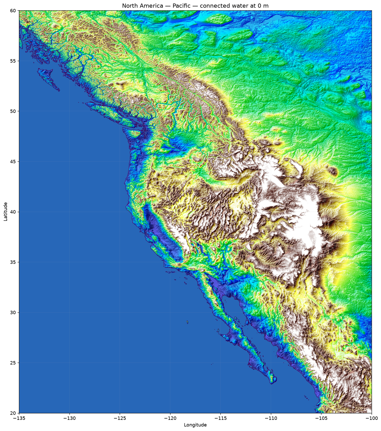
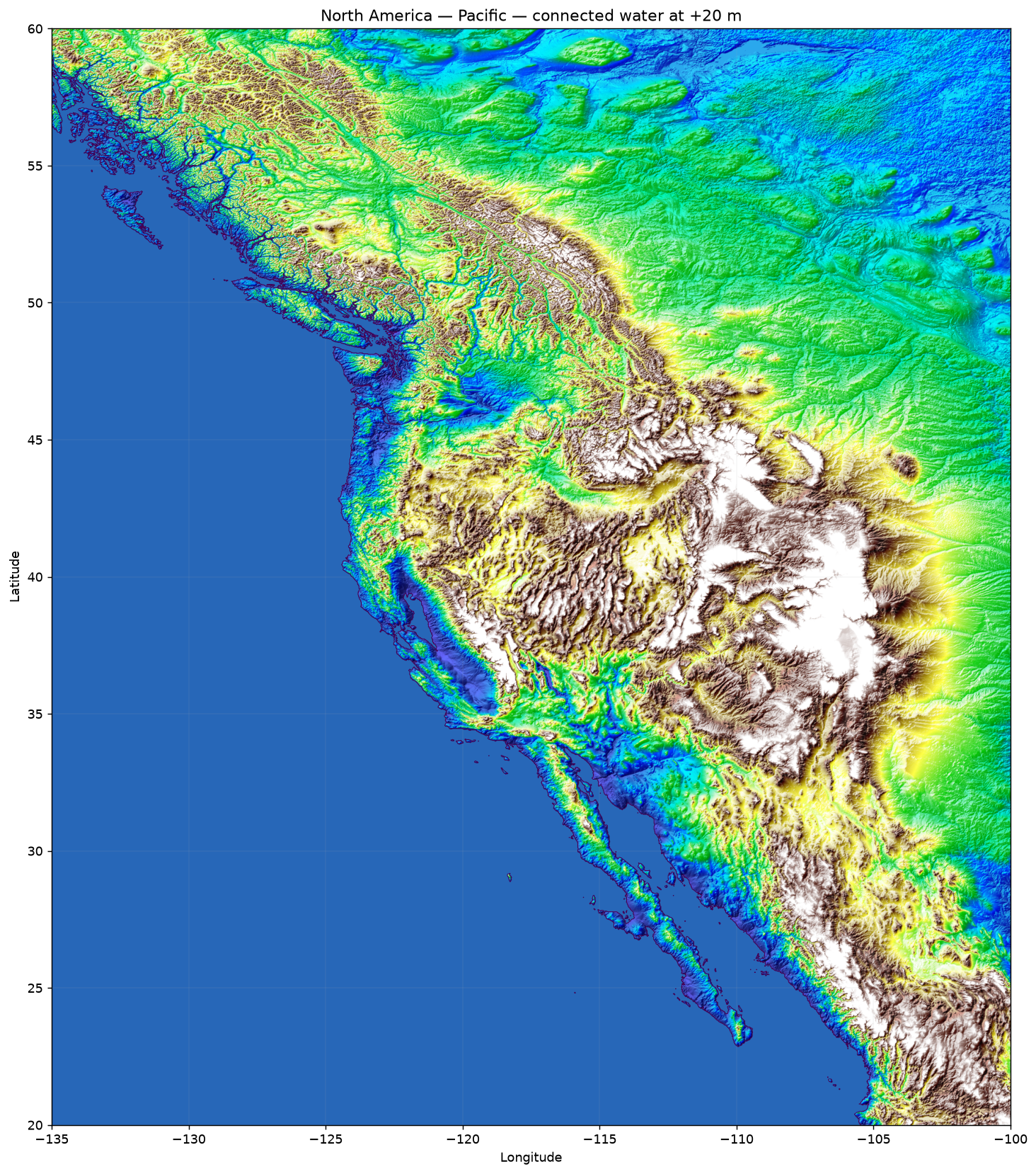
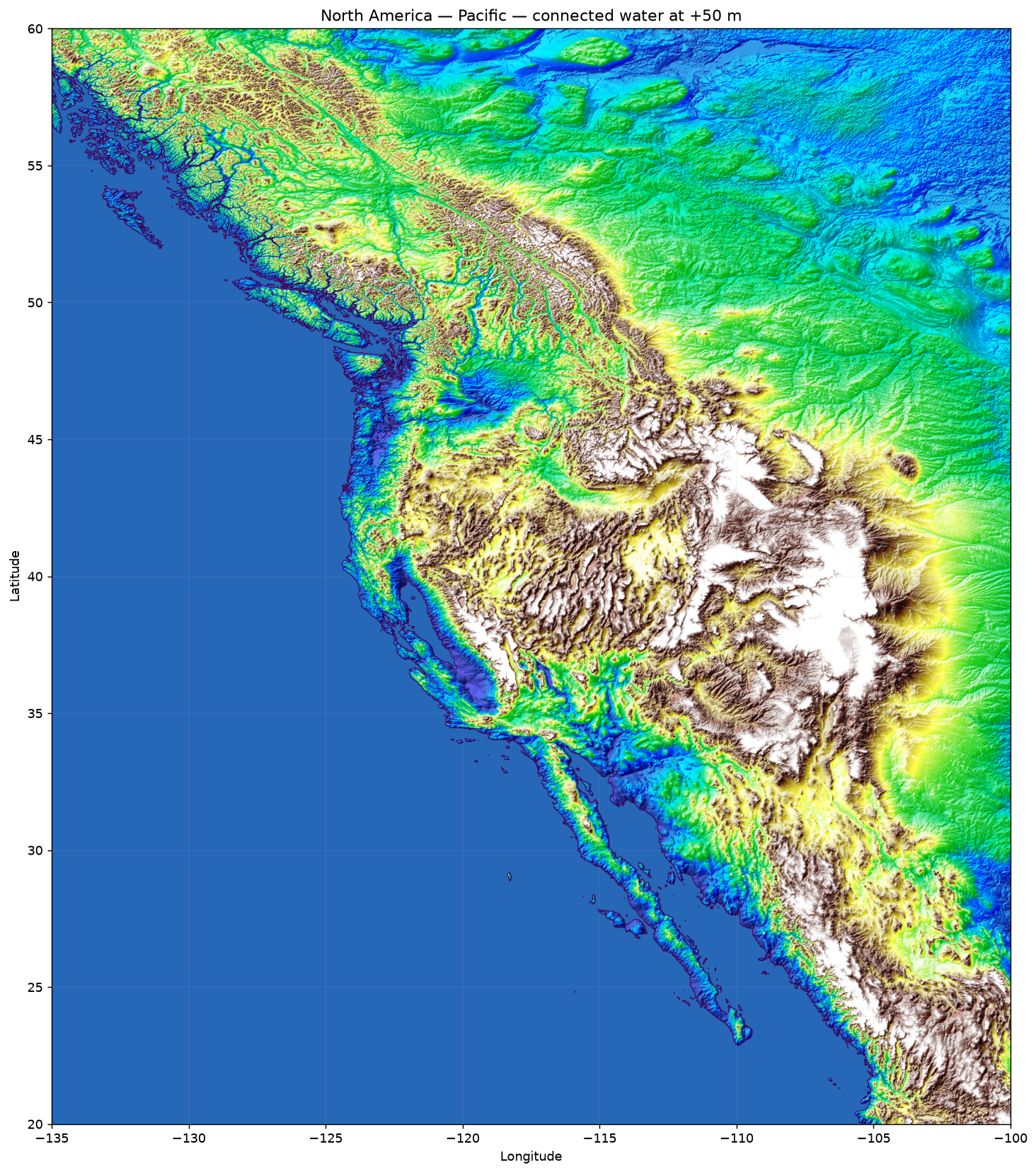
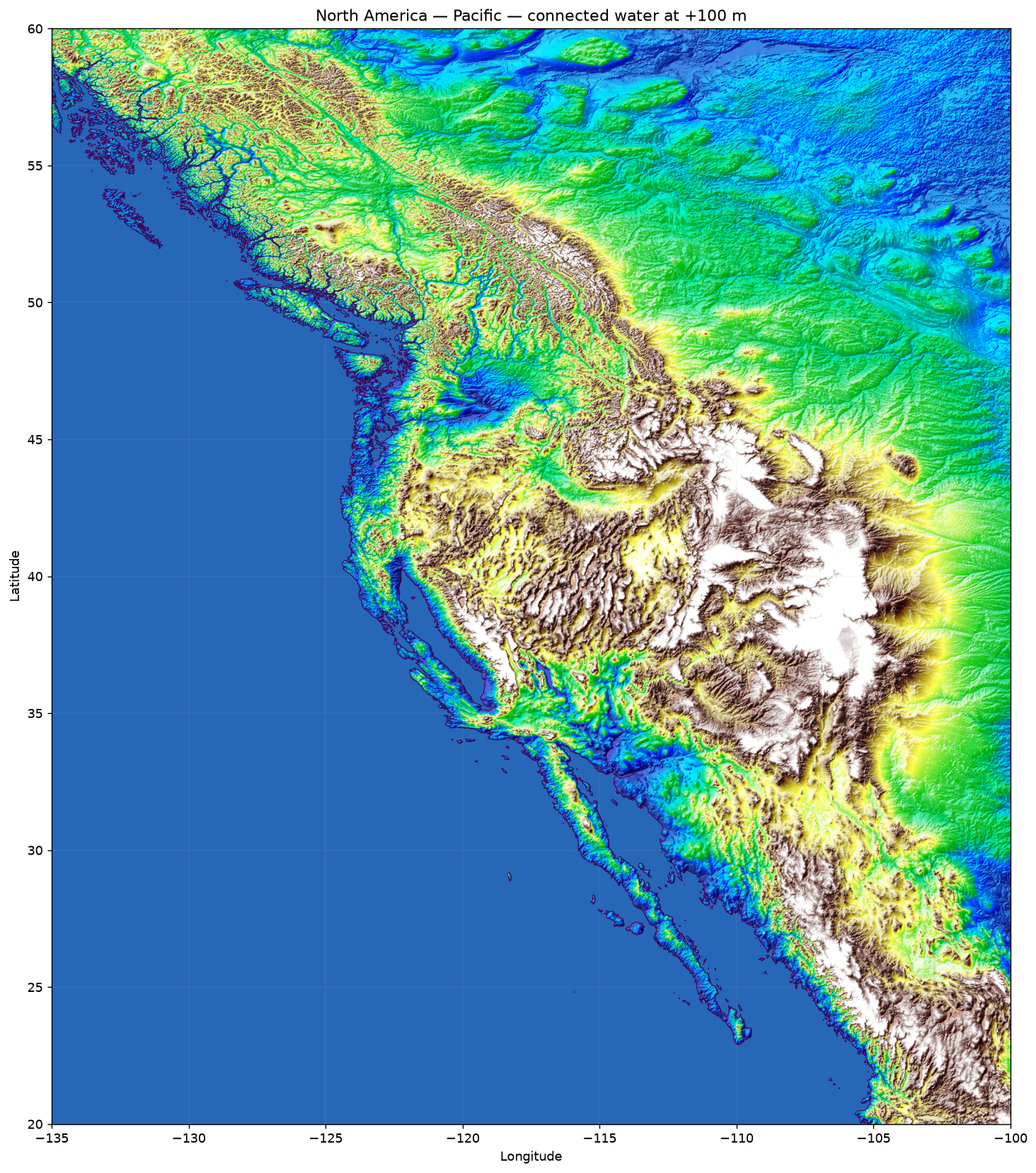
Compare current water outlines with the result of a 20, 50, or 100 metre rise. This is a terrain-connectivity experiment, not a climate forecast.
Method
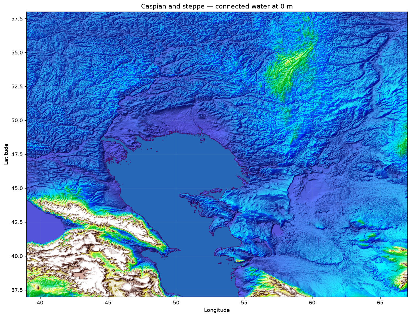
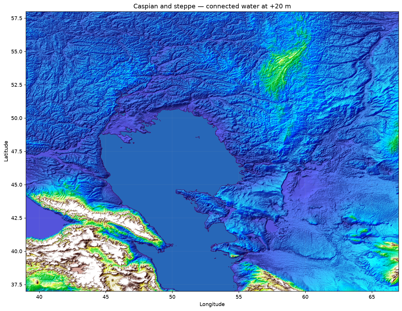
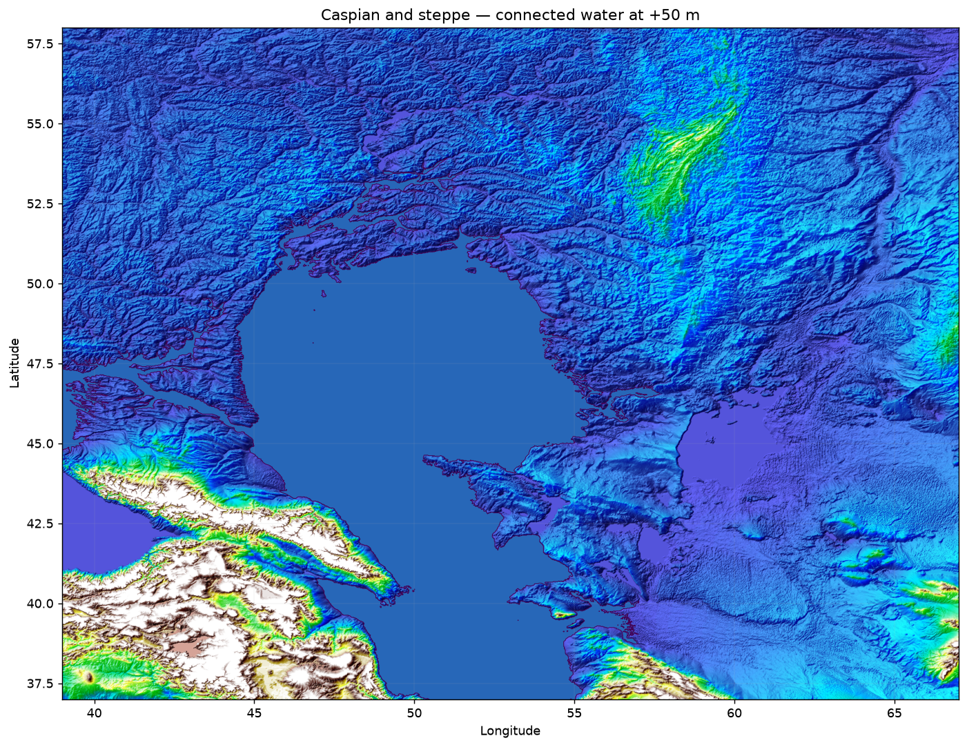
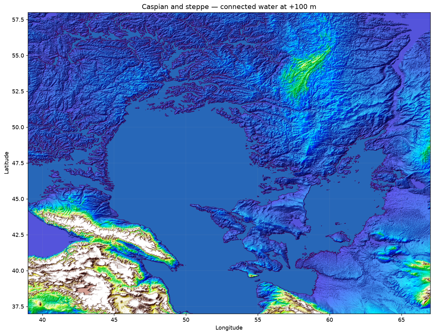
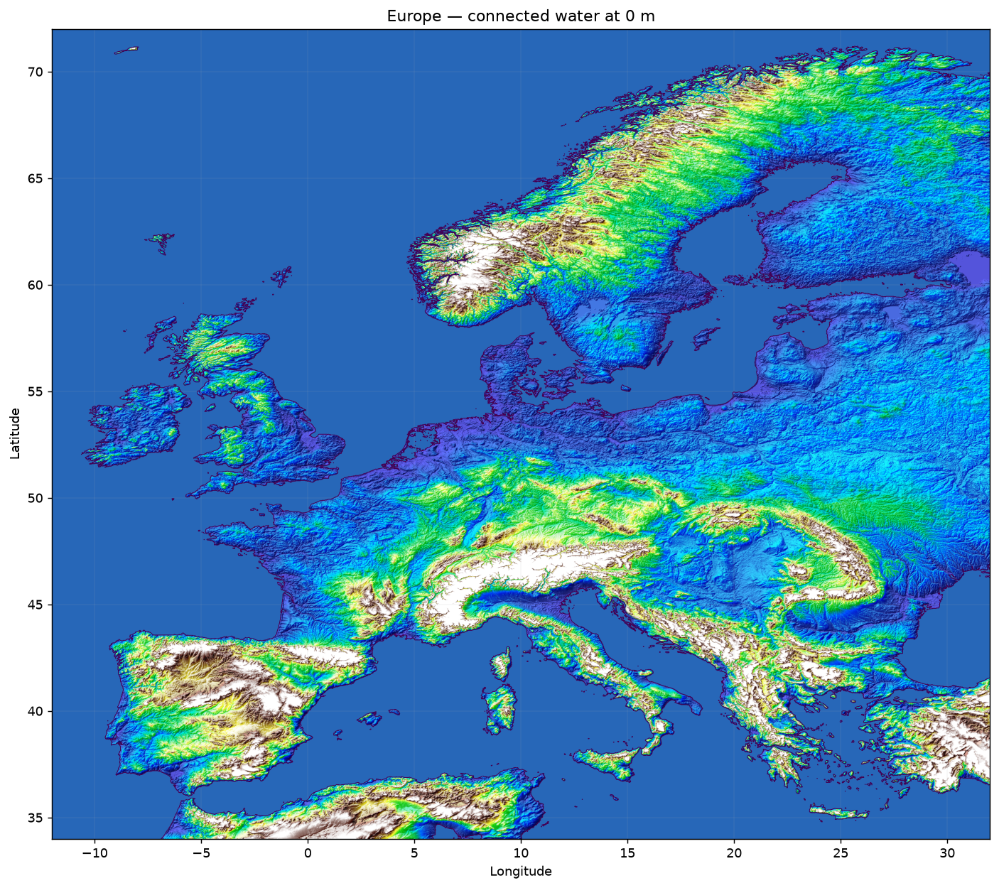
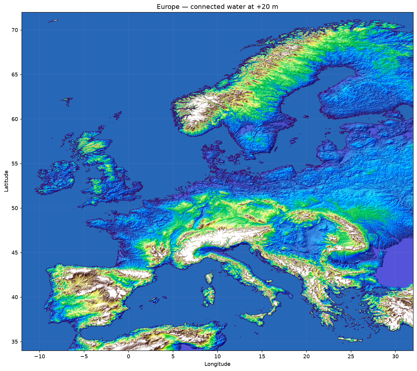
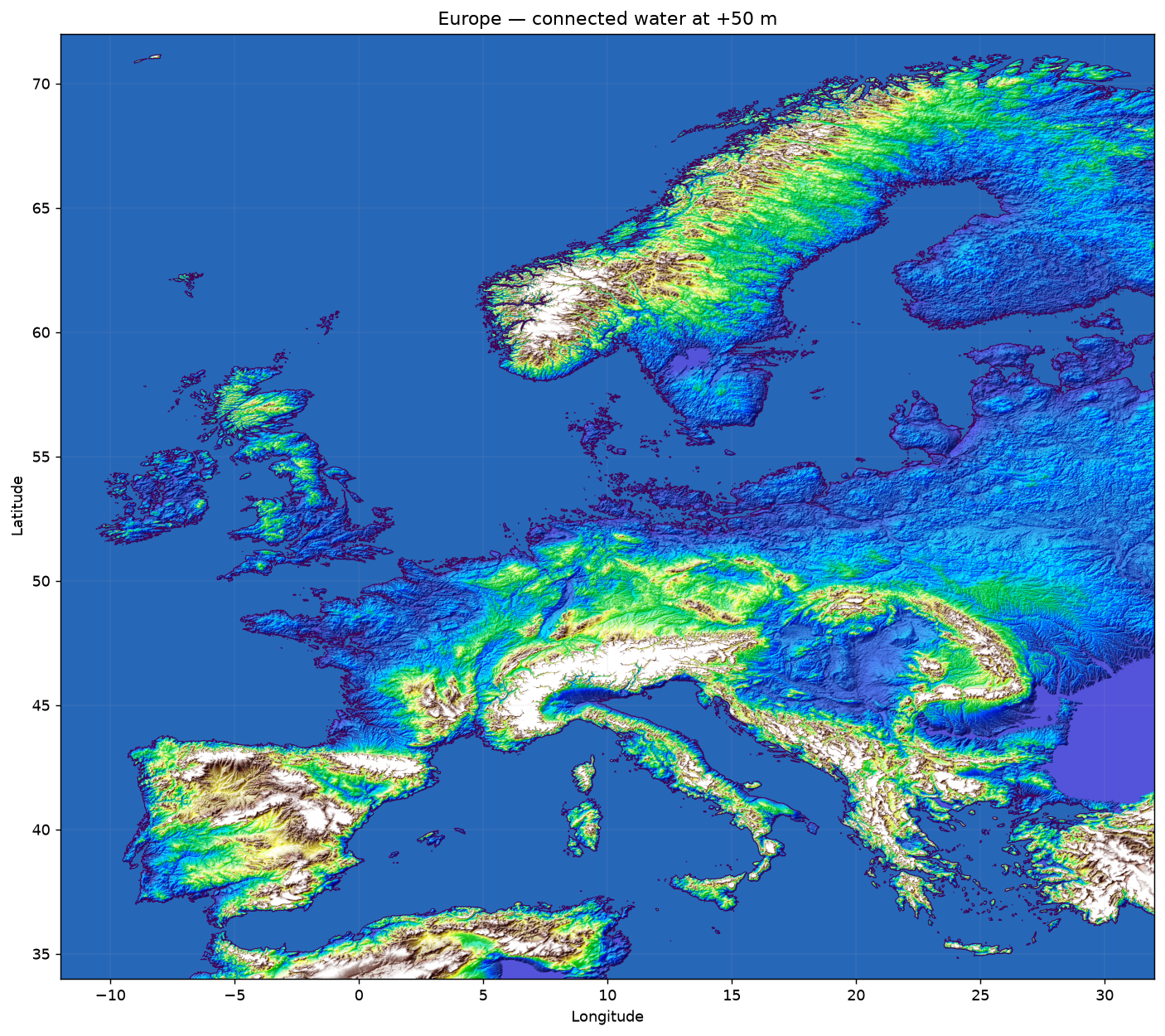
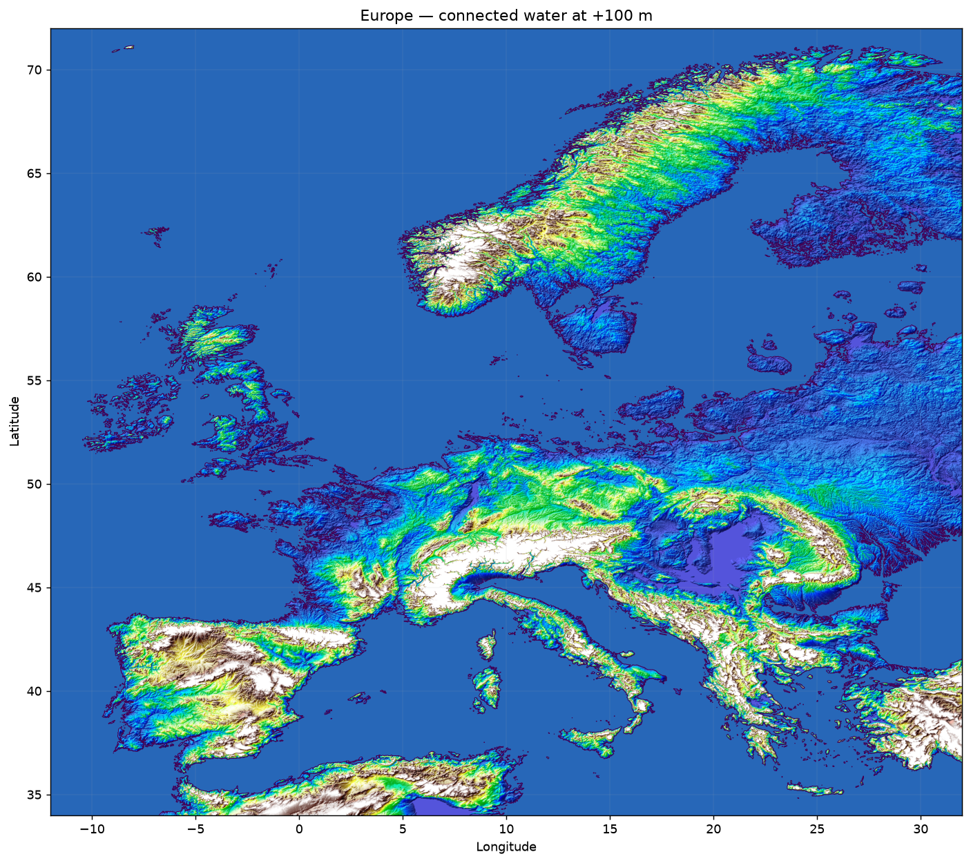
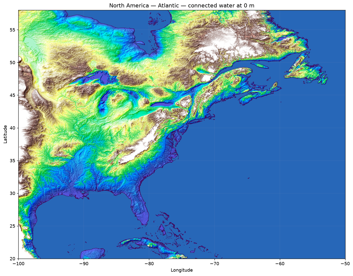
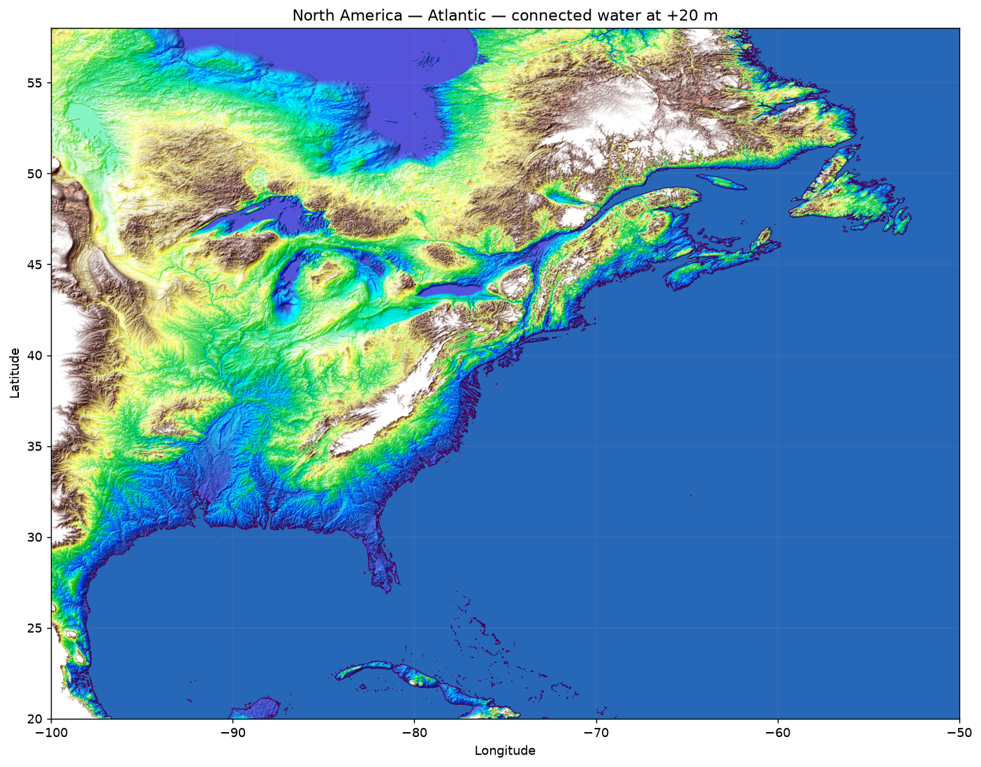
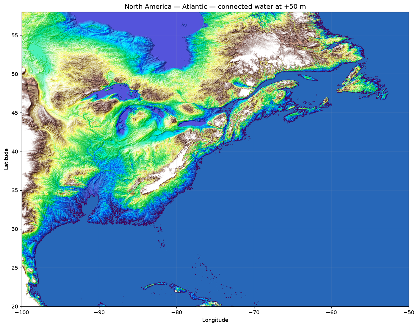
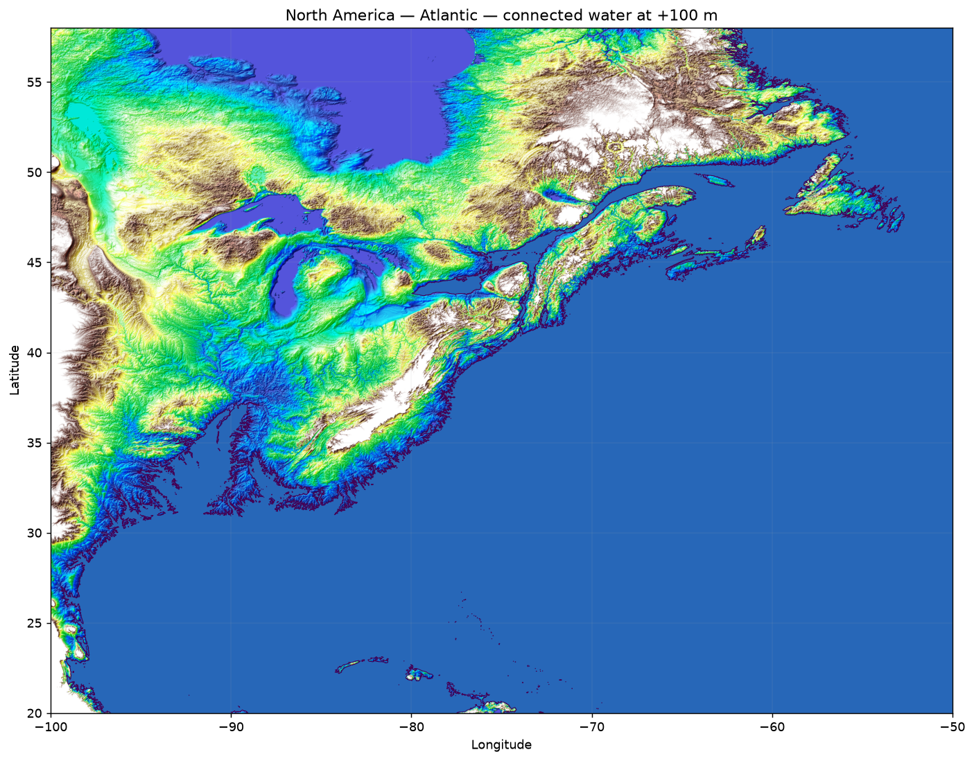
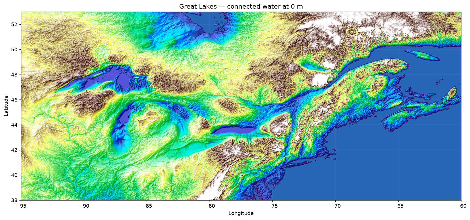
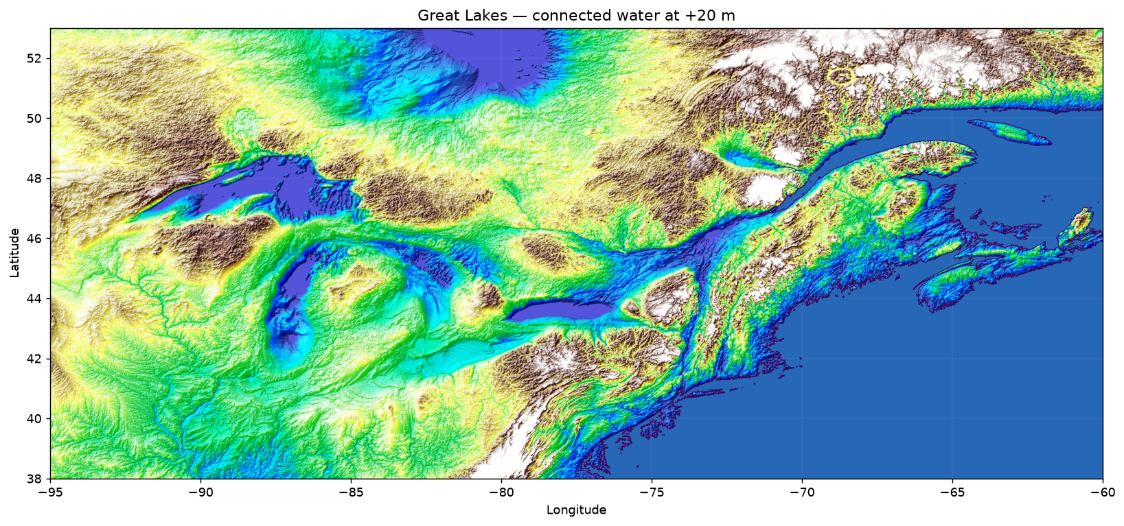
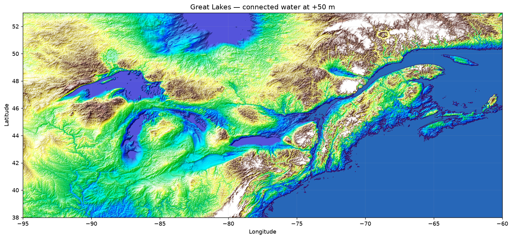
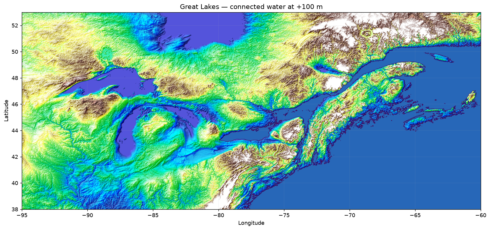
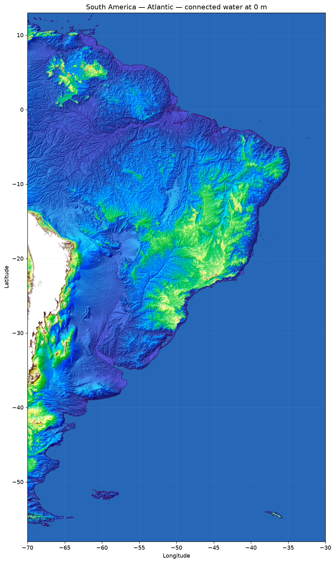
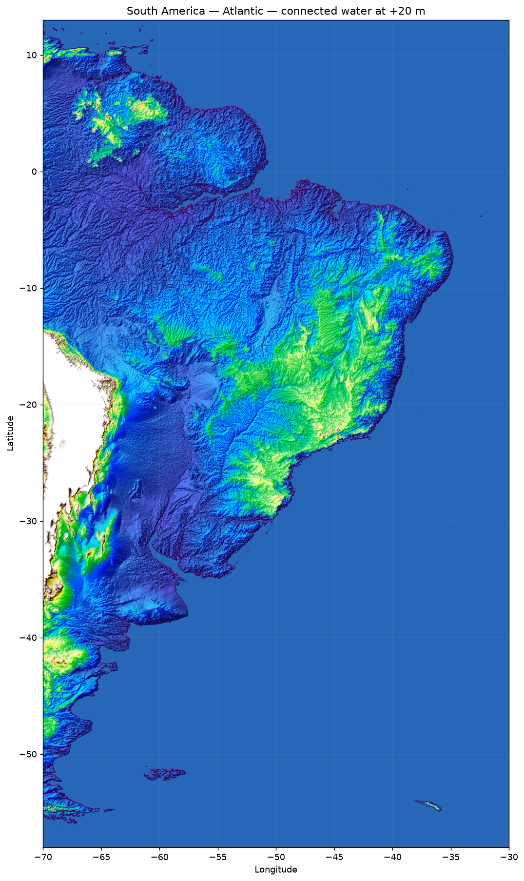
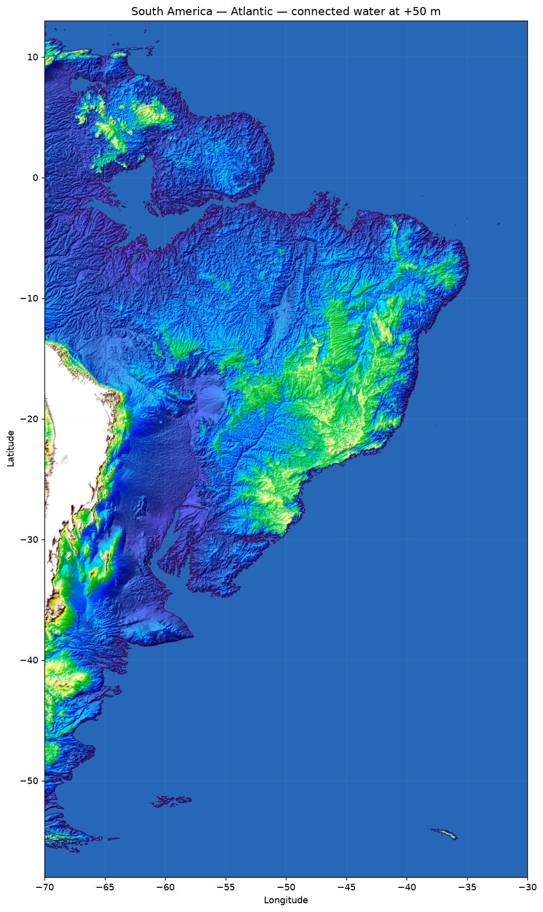
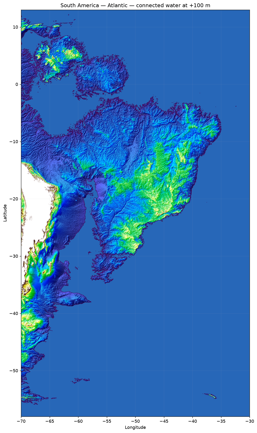
The utility loads the ETOPO 2022 surface and runs a flood fill from defined marine seed points. An isolated low depression does not become sea by itself: water must reach it through a continuous chain of cells at or below the selected elevation.
The local tool accepts an arbitrary bounding box, supports 15, 30, and 60 arc-second data, renders PNG output, and can also save GeoTIFF inundation masks and calculated water depths. The public regional maps use the 60 arc-second dataset.
- Terrain
- NOAA ETOPO 2022
- Web maps
- 60 arc-second
- Connectivity
- 4-neighbour flood fill
- Scenarios
- 0 / +20 / +50 / +100 m
Maps
Choose a region and level
Caspian and steppe
An anthropogenic basin-filling scenario seeded in the Caspian Sea. It explores sustained water transfer through the connected river-and-canal system rather than natural global-ocean inundation.
 Full size
 Full size
 Full size
 Full size
Europe
Atlantic- and Mediterranean-connected lowlands across Europe.
 Full size
 Full size
 Full size
 Full size
North America · Atlantic
The Atlantic and Gulf-facing side of North America.
 Full size
 Full size
 Full size
 Full size
North America · Pacific
The Pacific-facing side of North America.
 Full size
 Full size
 Full size
 Full size
Great Lakes
The Great Lakes and their connected route toward the Atlantic.
 Full size
 Full size
 Full size
 Full size
South America · Atlantic
Atlantic lowlands and major estuaries of South America.
 Full size
 Full size
 Full size
 Full size
South America · Pacific
The narrower Pacific coastal margin alongside the Andes.
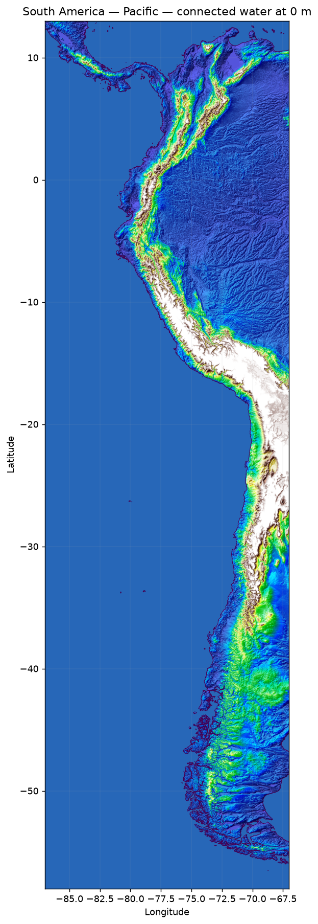 Full size
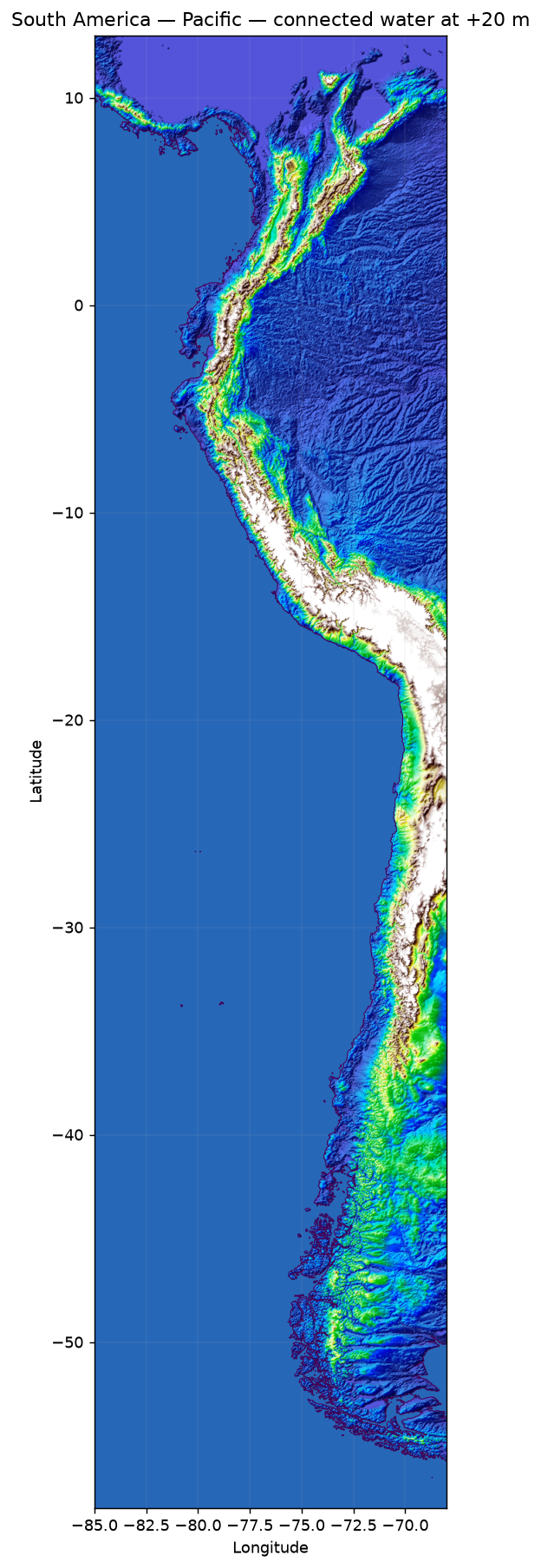 Full size
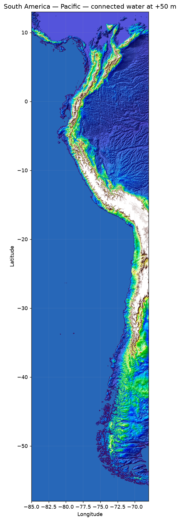 Full size
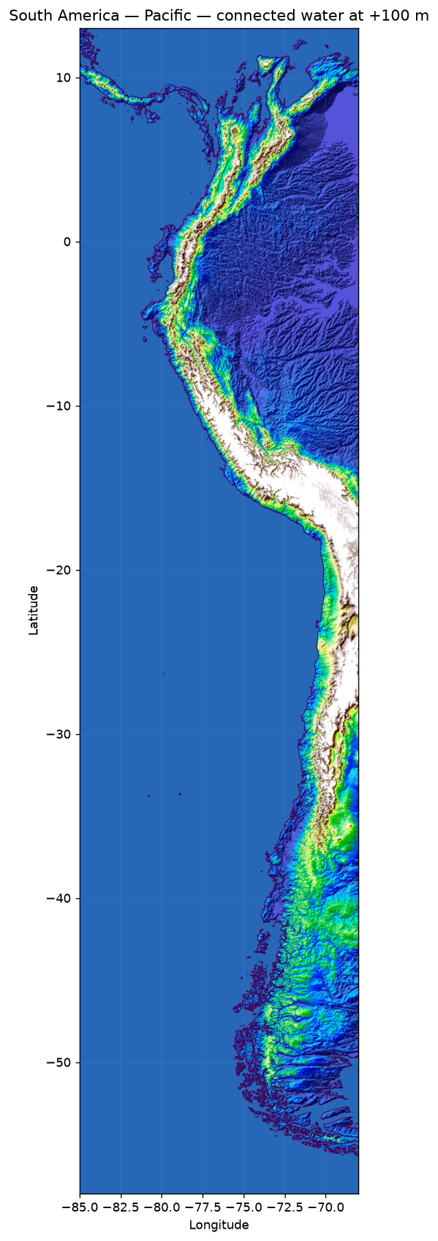 Full size
Southeast Asia
Deltas, peninsulas, and island coastlines across Southeast Asia.
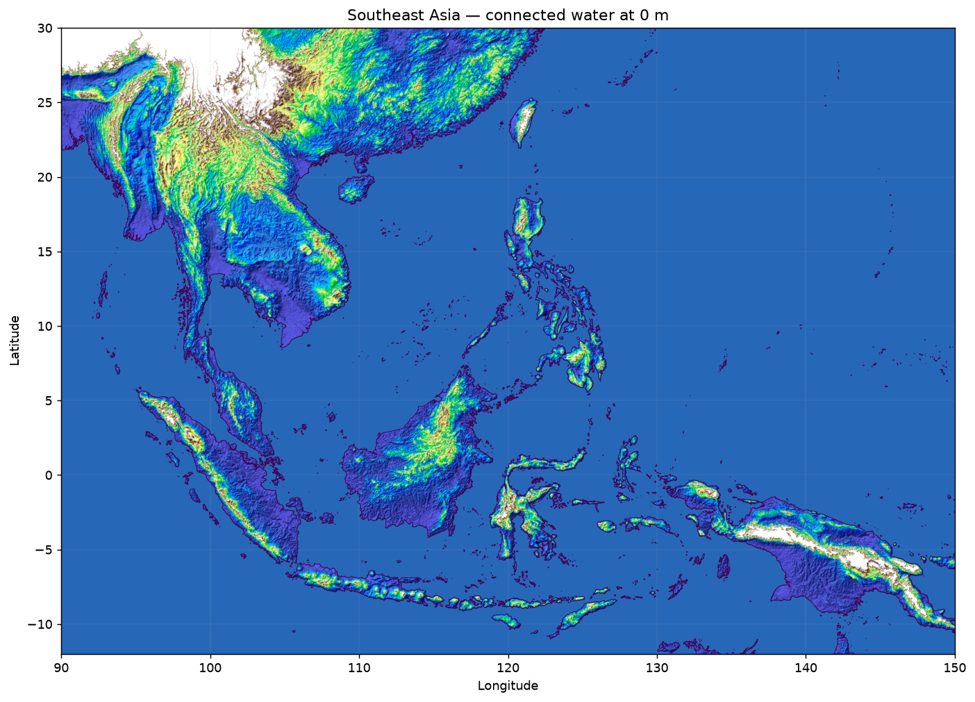 Full size
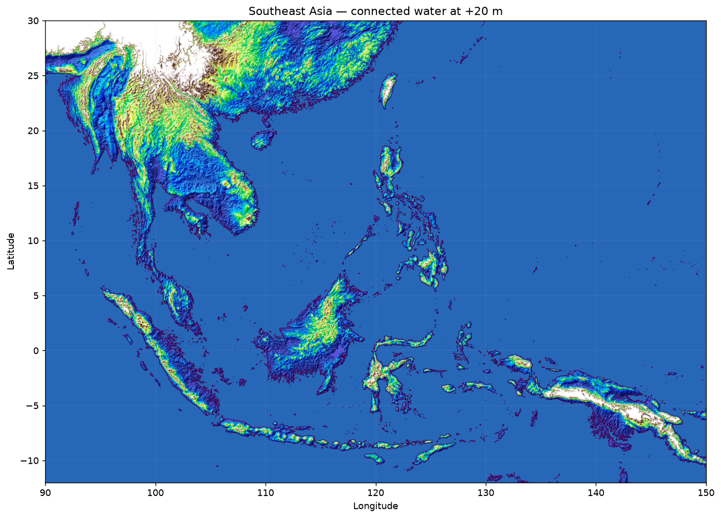 Full size
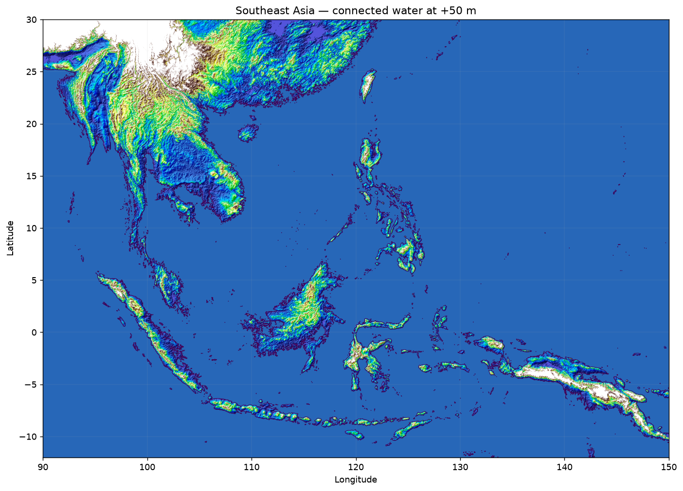 Full size
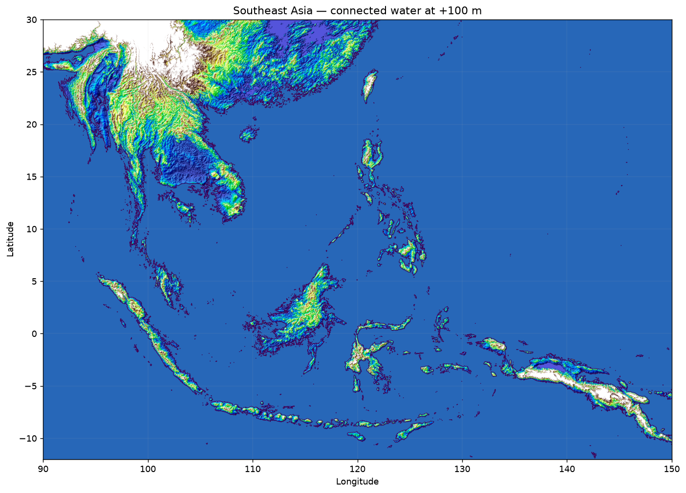 Full size
Northeast Asia
Northeast China, the Korean Peninsula, Sakhalin, and Japan at a closer scale.
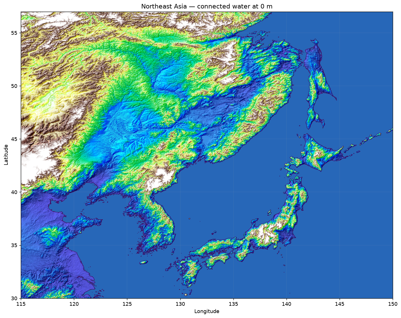 Full size
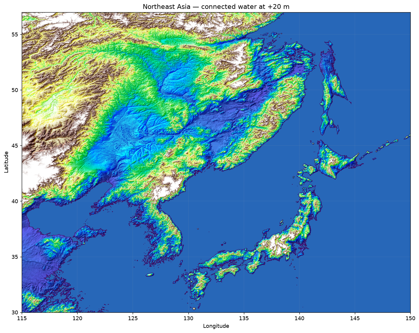 Full size
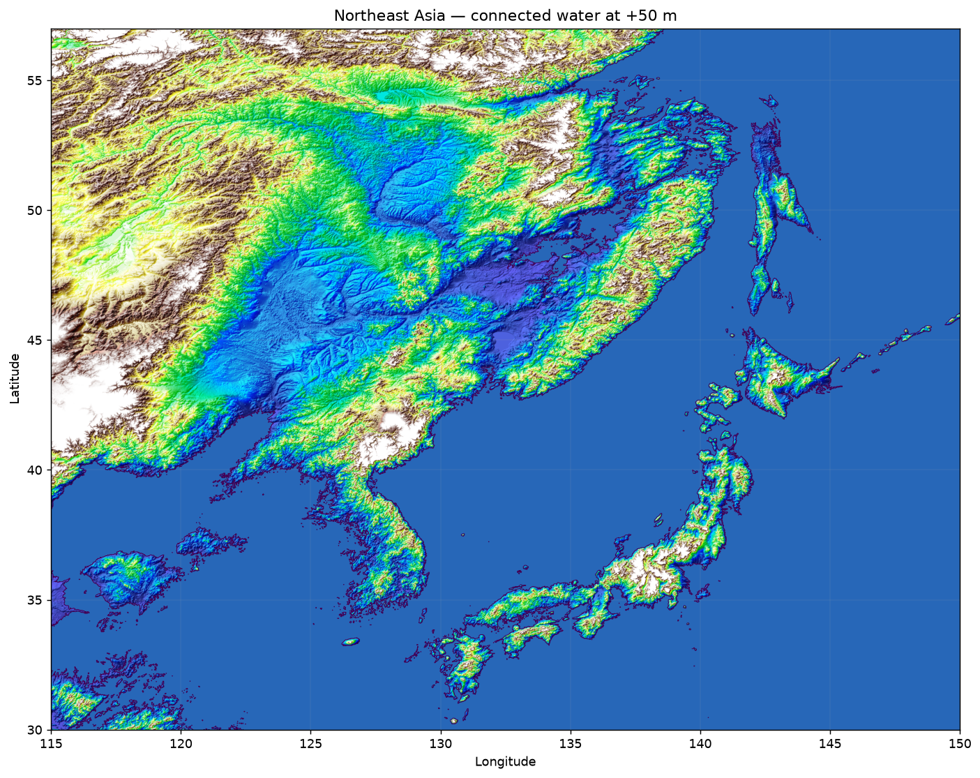 Full size
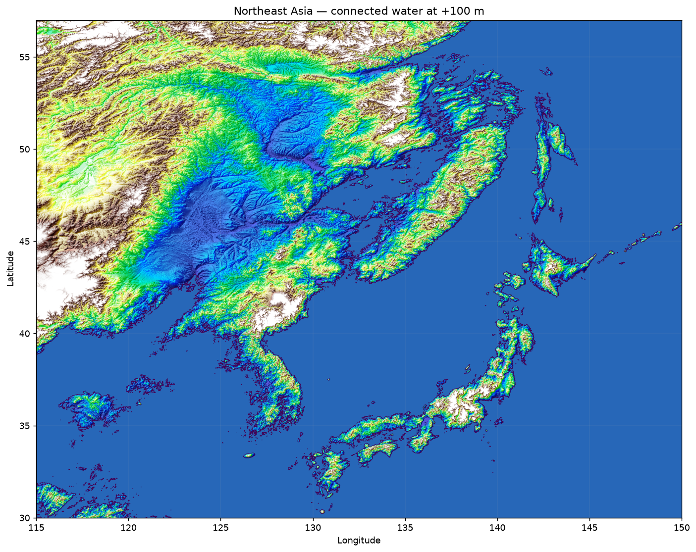 Full size
Limitations
A terrain study, not a forecast
The model assigns no timing, cause, or probability to water rise and does not include levees, locks, pumps, erosion, precipitation, or future coastal protection.
The 60 arc-second resolution is approximately 1.8 km in latitude. These maps support regional inspection, not street-, building-, or parcel-level assessment.